This is probably the most remote, impressive and also the most mysterious place in Mexico : a volcanic peak that rises to over 4000 m above the Pacific Ocean only 3 hours away from beaches and mangroves. This is the Tacana Coloso de Fuego, Central America. At its foot, in the heart of the jungle, coffee and cocoa trees produce the best cocoa beans and the best coffee in the world. It’s rise is a tribute to the Mayan culture. It also allows the possibility to cross paths with quetzals, tapirs, toucans, peacocks … In this exceptionally well- preserved biosphere live around 325 species of birds, many of which are endemic.
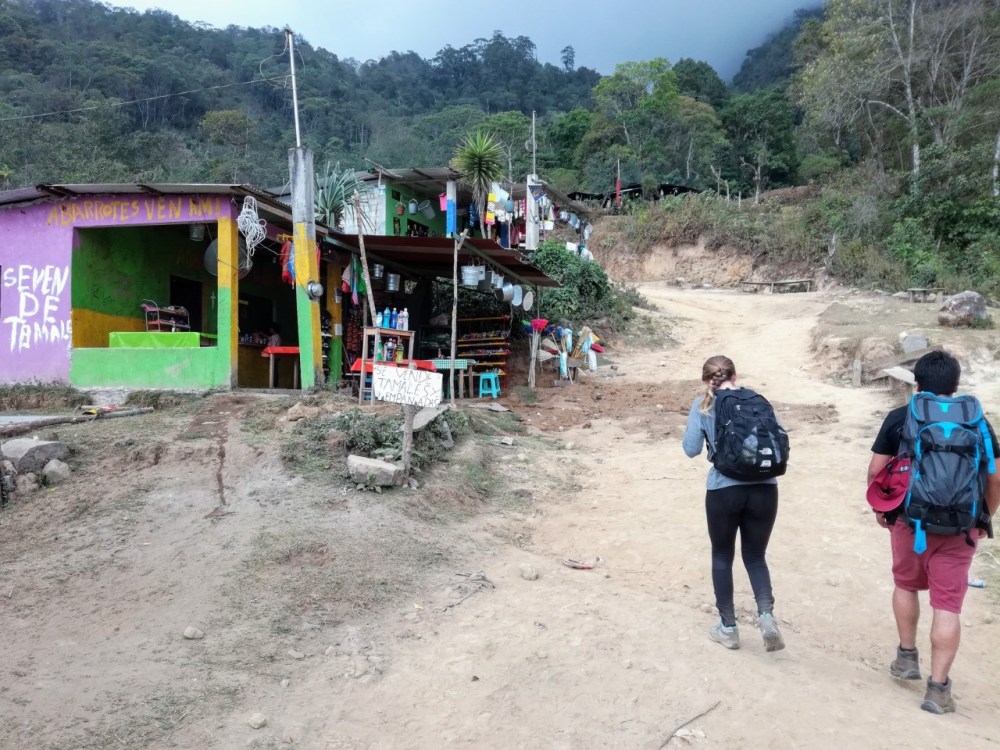
Tacana (Chiapas), february 2018 ! Finally, we’re here ! We’re on the Tacana, the roof of Central America, the revered Mayan mountain. It peaks at over 4000 meters, according to Mayan cosmogony, right out of the underworld. So this is why, this colossus (familiarly called The Lighthouse for all south Mexican marines who see it miles from the coast of Soconusco) is also called Casa del Fuego. The Tacana is indeed one of the most active volcanoes in the Sierra Madre of Chiapas * which last erupted in 1986. Further down, on the western flank of the volcano, about 2000 meters above sea level in the heart of selva, the village of Agua Caliente is known for its hot springs and waterfalls, where the waters are at 40 ° and streams run bright orange (due to iron hydroxide). But we’re here for another race and it’s going to take some 3 hours and 10 km up a winding and steep path.
* Its highest point is the Tajamulco, Guatemala, which stands at 4220 meters.
Tacnahuyú language Mam
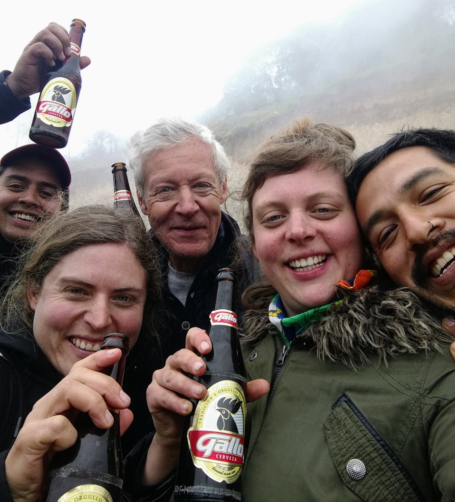
Yesterday by the mountainside, we made a welcome stopover in the Guatemalan village of Tonala (affected by a strong earthquake in September 2017) ; the only place before the summit to allow us a few cold Gallos beers at only 10 quetzals a bottle. The Mayan population still speaks Mam and so the Tacana just became Tacnahuyú or Tacnajuyú or Hill of the House of Fire. Another interesting fact, the top of Tacana is located on the dividing line between Guatemala and Mexico since the Treaty of 1882.
It is – 4 ° and we’ve been hiking since 4 am
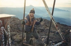
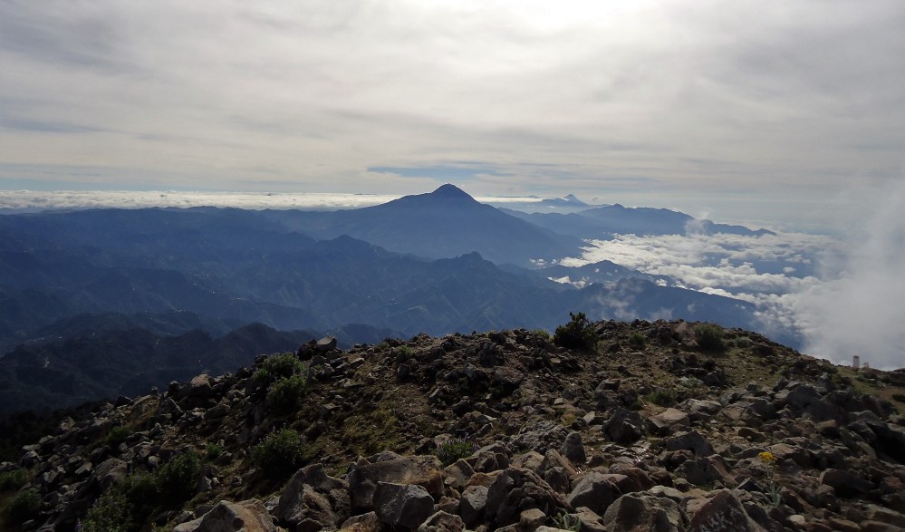
A few more rocks to climb up before we pull ourselves up onto the plato of scrap metal that symbolizes the peak of the volcano. It is hardly 7 pm. The air is bitingly cold. It’s minus 4°. We’ve been walking since 4 am. Amazing, these last 500 meters climb steeply along winding paths barely lit but our frontal torches. A phantasmagorical landscape, the pine forest mired in the fog, everything is white, slippery, with an impressive silence right up to the last crater, a vast flat expanse where we welcome the first rays of the sun. Is it Guatemala or Mexico ? An alignment of white bollards serve to demarcate the two countries (la linea). And where’s that bottle of champagne that was to seal our Franco-Mexican families (an Extra Brut) ! Sadly forgotten at the bivouac. So we make do simply with a bottle of bad brandy (but more comforting) bought in the “aborrotes” store in Juarez Union.

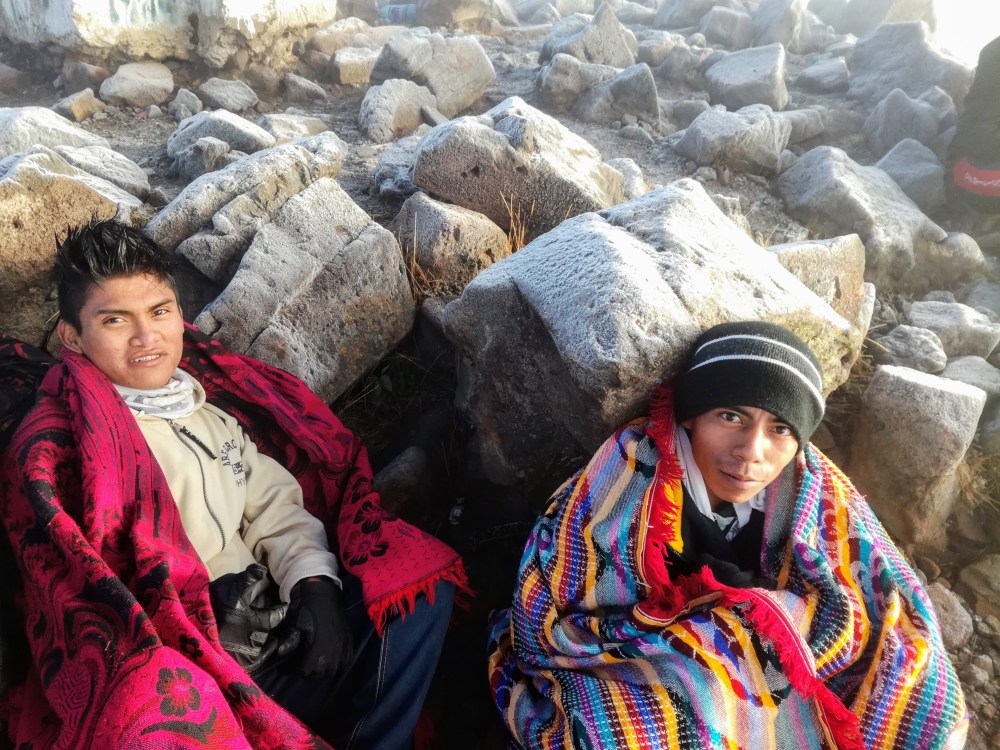
Exhausted kids
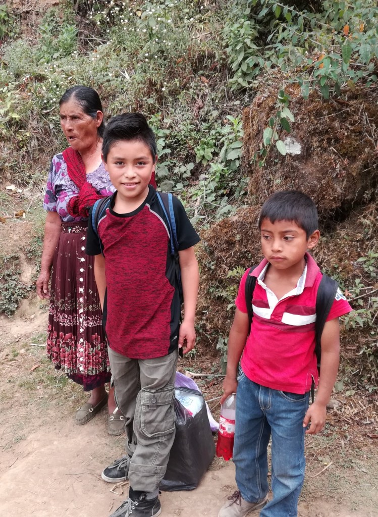
Talk about complaining about a too steep climb! Futile against this ragged string of Guatemalan kids (15-16 years) that we had overtaken all throughout the climb. Some of them hypothermic and which our cereal bars and survival blankets have at least served for something. They had been walking for 48 hours with already 100 kilometers in their legs, only to be abandoned at the foot of the volcano by an unconscious evangelical pastor. The strongest that had already made it to the summit were sitting huddled tight against each other under a blanket, the thickness of a cigarette paper.
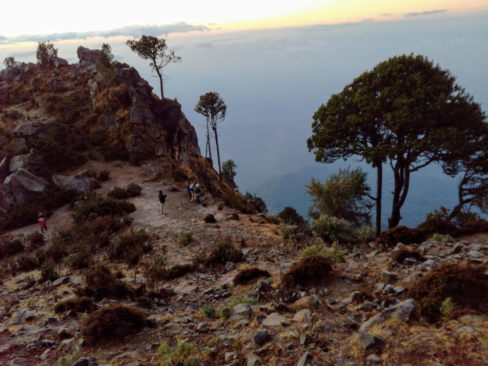
An incredible panorama of the entire chain of active volcanoes of Guatemala
From the summit, the view is stunning but that morning, sadly hidden by a light mist. So what satisfaction to see it better (but not fully) as the morning sun clears away some of the foggy clouds. What a shame, it should have been the whole chain of volcanoes of the Sierra Madre of Chiapas overlooking the coastal plain of the Pacific being offered to us : the Santa Maria (3772 m), the Acatenango (3976 m) and further on The Water and Fire, the Fuego (3763 m)* with its smoky wisps located around the former capital Antigua of Guatemala and finally, The Agua (3760 m). Towards the Southwest we should have seen the city of Tapachula, the capital of the province of Soconusco right down to the beaches and the beautiful mangroves of the Pacific.
* The most violent eruption of Guatemala’s Fuego volcano : in june 2018, at least 110 people have died and close to 200 are thought buried under the rubble in the hamlet on the fertile lower slopes of the volcano. Fuego – Spanish for “fire” – rises between the regions of Sacatepequez, Escuintla and Chimaltenango about 30 miles (50 km) from Guatemala City.
From the jungle to the pastures
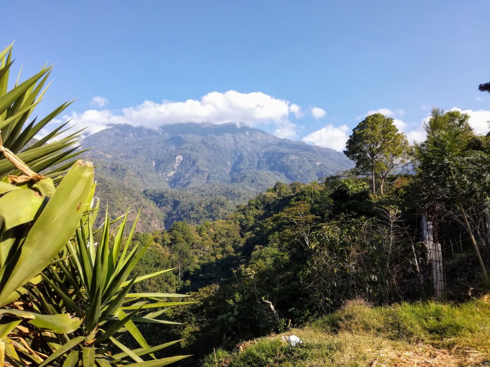
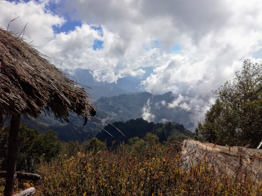
But what a contrast ! 48 hours earlier, we arrived by taxi (400 pesos -22 USD- after negociation) from Tapachula to Unión Juárez (also called the Switzerland of Chiapas), starting point for the ascent of Tacana, in the famous Biosphere Reserve listed by Unesco in 2003. La Selva rainforest (jungle) moist and dense prevailing on the green slopes of Tacana became one of the last refuges in Mexico for the sumptuous and legendary quetzal (emblematic bird of Guatemala who gave his name to the currency, the quetzal). But this Selva, one of the richest in Central America today is victim of a devastating deforestation. If the native cocoa (criollo) are still present in the shade of large trees *, the coffee trees on thousands of hectares have often supplanted rare species trees and palm trees, an ecological and human disaster !
* In this ancient Aztec province Xoconocho (Soconusco) the village of Cacahatan at the foot of the volcano means in Nahuatl, Place of Cacao.
Bivouac at Plan de los Ardillas
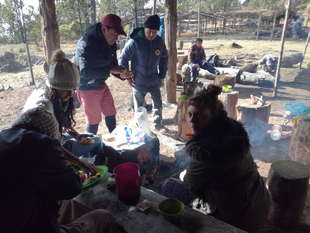
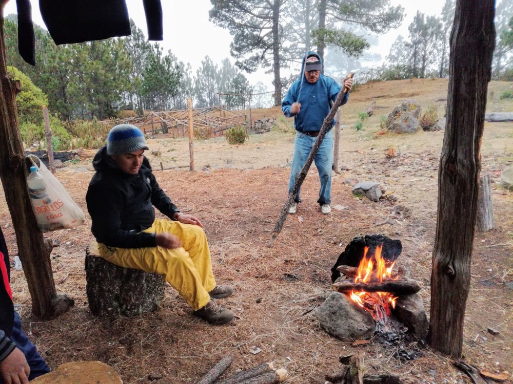
The night before inTalquián, at Plan de los Ardillas where we slept, which was not the best workout to get the legs going for this course : 5 hours to cross 2000 m at altitude (from 1667-3672 m) with slopes of 30 to 60 % (hard, hard, hard !) ; vegetation was deciduous, coniferous and with some surprising pastures. Arriving at camp, the famous Plan de los Ardillas (squirrels), the rain increased, giving us just enough time to take shelter under frail roofing sheets nailed to beams covered with graffiti. Romeo, the guide reassures us : at midnight you will see one of the most beautiful starry skies of the world, and tomorrow everything will be white. The mules arrived with tents and the kitchen. The cold fell upon us. We warm up by the wood fire, it is difficult to swallow the chicken soup, nobody really feels like staying up too late but it’s hard to find sleep. Tomorrow is the big day : alcanzando cumbres para conquistar sueños.

The promise to Romeo
This climb is the fulfillment of a promise. It all started here, at the foot of Tacana 7 years earlier with the young Romeo, 17 years old ; long hair, ponytail, idle schoolboy, pot head (Porro)… and infinitely friendly. He was just the guide available that day at the Cooperativa de guías – Casa de Fuego of Juarez Union. I was with two of my daughters, the youngest 9 years and older who lived more than 300 km away, in San Cristobal de las Casas. He looked at us with all of his years of experience (later we learned that unbeknownst to his family he had accomplished his first ascent of Tacana at 11), examined our equipment : no decidedly the ascension was not for us. A coffee with his mother, a machete borrowed from his uncle and we’re off to visit the waterfalls of Muxbal and Monteperla. On the way, with a certain detachment, he showed us the exact site of the massacre of ten narcos (or traders) who were thrown over the precipice. At the foot of the Pico de Loro with its incredible views of the Tacana and Tajamulco, we left with the promise to meet again. But then Romeo realised he had forgotten the uncle’s machete on top of the peak, so he was off again ! The contact was never lost. He is now a young man of 25 father of a little girl and one of the most accomplished Mexican guides. His company is thriving. He installed his mother at the head of one of the finest restaurants in Juarez Union. And ironically, being on another run on the other side of Mexico, he delegated his father, Romeo to replace him.
Chocolate in the garden of Eden
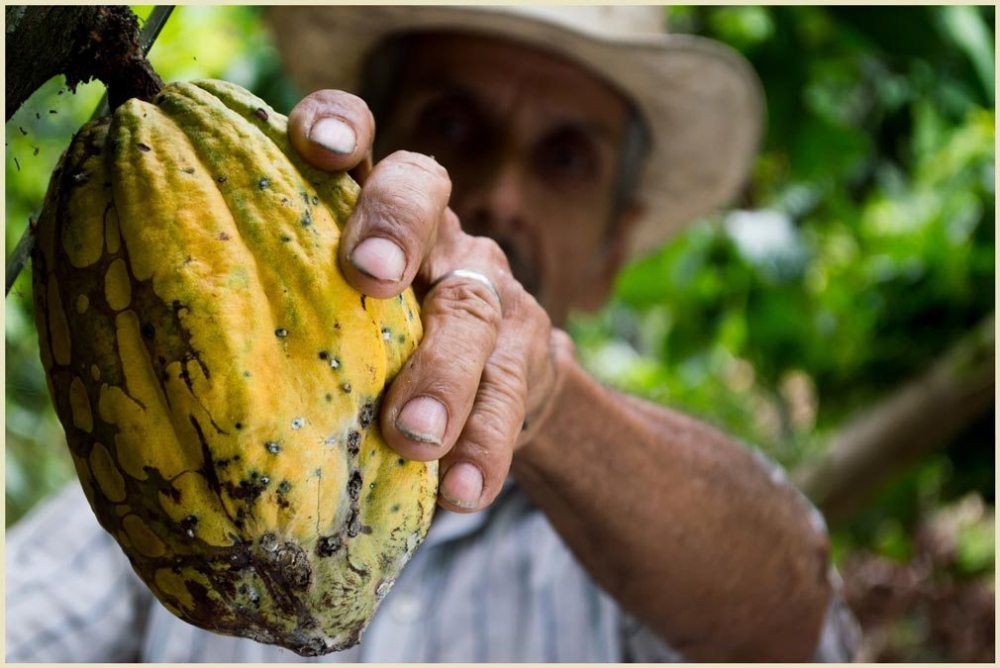
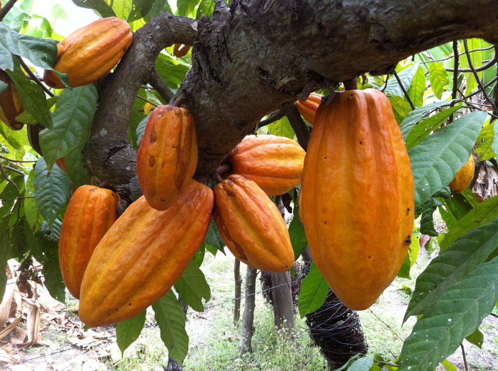
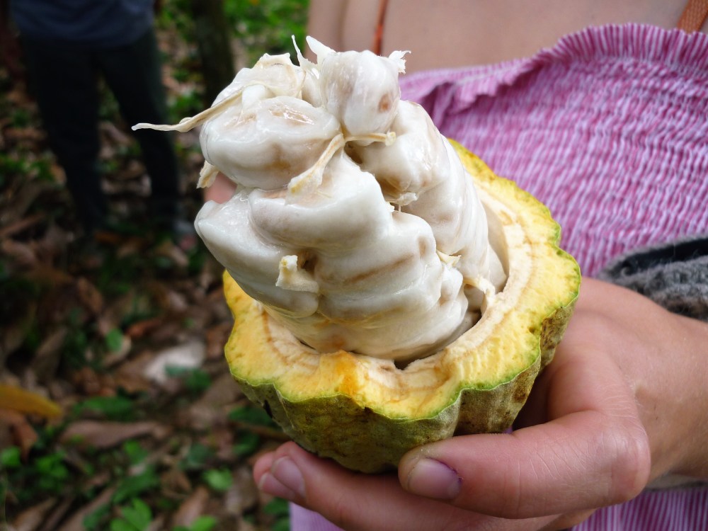
That year, we were to complete an incredible journey in the Soconusco in search of cocoa, from the flank of Tacana to the high mangroves of La Encrucijada on the shores of the Pacific Ocean. Is this not a kind of Garden of Eden where the seeds of native cacao trees grow twice as fast as normal (on the islands of La Palma and El Campon). We started with the planters on our discovery of cocoa, these varieties of criollo and pataxte (always from Mokayas to the Olmecs and the Mayas) that were growing there are already ten thousand years along the Suchiate River, on the Guatemala border ; cocoa with astonishing, sticky pulp around its white or pink seeds and pods which are jade green to blood red.
Izapa, Mixed-Zoque site on the road to the Tacana
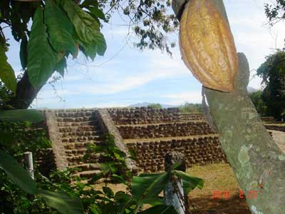
We wandered in the empty Izapa during the first heavy rains of the season, which served to madden thousands of birds. This still so mysterious site is nestled in the heart of the cocoa plantations. Its origin is the Mixe-Zoque civilizations linking two of the greatest cultures of Mesoamerica : the Olmec and the Maya. That places it some 800 years before to 50 AD.
Here, it’s amazing! Everything is under the sign of chocolate. The Mayan cacao glyph seen at Izapa, according to the Popol Vuh * is represented in the form of twin fish accrediting the age of the ceremonial and social use of cocoa. Even more troubling, the glyph of a catfish with a reading Kakawa or Cocoa and further, the representation of a pod barely visible because of erosion. Through analysis of theobromine residues found on terracotta mokayas vases found south of Izapa, it is possible to date the consumption of cocoa-based beverages from 1900-1500 BC (the so called dawn of civilization).
* Creation of the World told by the Popol Vuh of the Maya-Quiches.
Chocolate yes but the best in the world
At the end of a barely passable track, 44 km from Tapachula, here is the expected reward, the famous Chocoleria San Jose (Ejido Aquiles Serdan to Mazatan) where Raúl carries in his pickup he is the manager CASFA* from the Red Maya Organizaciones Organicas, the oldest and most popular organic cooperative of Soconusco. It includes 119 small cocoa farmers with the organic label. They cultivate the ancient Criollo cocoa which is considered one of the best chocolates in the world because of the very fine aromas. For us, this is the perfect opportunity to sample their chocolate bars and the famous tamale sweet version, corn paste (masa) with rice flour, stuffed with almonds, chocolate, with a little chille ( but not too much, to clarify !) and wrapped in a banana leaf and steamed (delicious !).

 The last word from Stephane Bonnat (Chocolate Master) at Voiron (French chocolate company) : we consider the cacao Real Soconusco as the best in the world. It was probably the first cocoa domesticated by humans, Mokayas **. This pre Mayan civilization were living on the flanks of the Tacana, worshiping the Casa del fuego which we had just climbed !
* CASFA (Centro de Agroecologia Saint Francis of Assisi) in Tapachula directed by Jorge Aguilar Reyna.** Mokaya or The Corn People in Mixe-Zoque language which they no doubt spoke
The Tacana practical advice
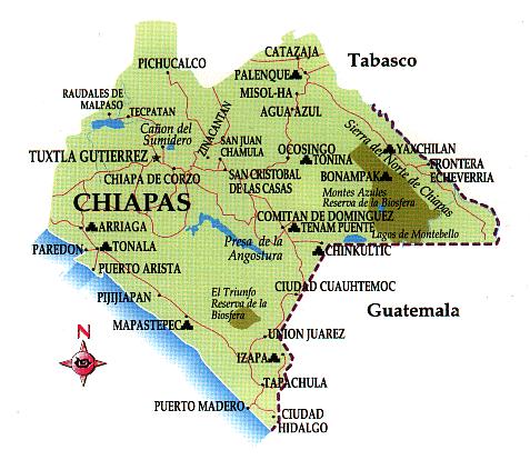
The Tacana is located in the province of Soconusco (Chiapas), in the extreme south-west of Mexico, close to the Guatemalan border. Mexico City is 876 km, Tuxtla Gutierrez, capital of Chiapas state to 218 km.
How to get there ?
- Several daily flights from Mexico City to Tapachula in 1:56. The company Volaris offers flights from 770 MXN (44 USD).
- From San Cristobal or Tuxtla, bus OCC company provide several daily connections.
- Tapachula, taxi to Union Juarez. Between 350 and 550 MXN (between 20 and 34 USD) after negociation with the driver.
Where to stay ?
- In Tapachula Hotel San Francisco Calle Central Sur Oriente 94, Centro, 30700 Tapachula de Córdova y Ordoñez (Phone: +52 962 620 1000). Room for 2 (including a hearty breakfast) : 1200 MXN (65 USD).
- In Union Juarez and Santo Domingo (at the foot of the volcano) : the choice is vast. Many Airbnb offers cabanas (interesting if you are in a party). Prices are around 350 MXN per person (18,5 USD). In Union Juarez, 3 possible hotels (Morayma, Colonial Campestre and El Encanto).
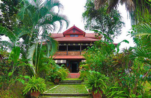
- Charming hotels set in extraordinary environmental framework (see below, Ruta del café)
Climbing with a guide (essential)
The guide will ensure the logistics of the climb over 2 days (tents and food transported by mules). It will ensure the safety of the group. UNION TRAVEL operates since 2010 from Juarez Union. His rates are competitive and probably negotiable depending on the season :
- 1 person : 3000 MXN (161 USD)
- 2 persons : 2700 MXN (145 USD)
- 3 to 5 persons : 2500 MXN (134 UDS)
- until 10 : 2350 MXN (126 USD)
Book with Romeo Angel Leon Ramirez Phone : 962 211 50 65 (He can advise and book for you, cabanas and hotel rooms). Avoid Easter and christmas for these two holiday seasons and especially Holy Week (Easter) it would seem that the Tacana gets to meet all lovers of Mountaineering and mountain hikers from all over Mexico, Guatemala, El Salvador … leaving behind a long trail of waste (not always picked up by the authorities).
For the climb, all you need to know and take
You should know that goes from very hot to very cold ; the ascent is difficult you have to be in great shape. Indispensable, very good hiking boots. All equipment for a 2-day mountain trip with a night at 3500 m altitude. Expect temperatures that can drop to -5 ° (backpack, sleeping bag, thick socks, gloves, jacket with hood, hat …).
The famous Ruta del cafe around the Tacana
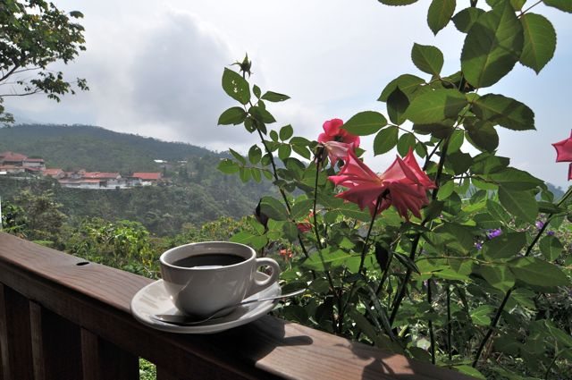
The Soconusco and including sections of Tacana produce one of the best coffees in the world. To discover the plantations follow the different stages of production (reception of the fruit, fermentation, washing, drying, storage and classification), the famous Ruta del café. The 5 most beautiful areas almost all transformed into charming hotels in ideal surroundings are fincas :
- Irlanda
- Argovia http://www.argovia.com.mx
- Hamburgo http://www.fincahamburgo.com/
- San Francisco
- La Chiripa
There are also dozens of small producers who produce their coffee from trees that grow almost wild. The result is a vintage 100 % organic arabica bourbon from the Caribbean and whose culture dates back to the eighteenth century.

Wouah! Amazing!
LikeLike